Tuesday, September 17, 2024

Why We Chose Serengeti for Our African Safari – Serengeti vs Masai Mara vs Kruger

Choosing the right destination for an African safari can be confusing. The Serengeti in Tanzania, the Masai Mara in Kenya, and Kruger National Park in South Africa are among the most renowned wildlife reserves in the world. While planning our first safari, we compared these three destinations based on cost, logistics, wildlife sightings, and our travel constraints.

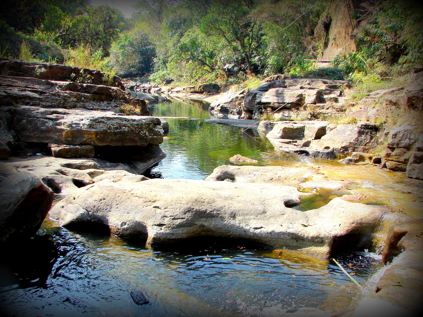
A Lioness Pride in Serengeti National Park

The African safari had been on my bucket list for a long time, but it always felt far beyond my travel budget. This time, however, I decided to just go for it. After COVID-19, decisions have become quicker—who knows what tomorrow holds? The mindset has been simple: if you want to do something, just do it today.
With only 10 days of vacation and limited funds, we had to plan carefully and make the most of the trip within those constraints.

We wanted to experience the Great Migration, so late July to early August was initially pinned as our travel window. Unfortunately, by then almost everything for August was already booked, and we had to plan our itinerary around the dates when accommodation was still available inside Serengeti National Park.

Lesson learnt: if you’re planning a safari trip, plan well in advance. To secure good accommodation at a reasonable price, it’s best to book at least six months ahead of your travel dates. We were only four months away from our target date—and it was truly late!

Our final itinerary included three days in Zanzibar, four days in Serengeti National Park, and two days reserved for travel. Part of the family flew from Delhi to Zanzibar via Mumbai and Dar es Salaam, while the rest traveled from Milan via Doha.

Air Tanzania operates direct flights to Zanzibar and Arusha from Mumbai via Dar es Salaam. The reason we preferred this route was simple—we wanted to avoid the yellow fever vaccination requirement!

Yellow Fever Vaccination Requirements for Tanzania

Tanzania is not a Yellow Fever endemic zone, as recognized by the WHO. If you fly to Tanzania directly from a non-endemic country and depart directly to another non-endemic country, the vaccination is generally not required, although some travelers may still choose to take it as a precaution. However, if your journey involves transit through a Yellow Fever endemic country, the vaccination becomes mandatory.

We were traveling with septuagenarians who are at a higher risk of serious side effects from the vaccine, so we wanted to avoid it if possible. In fact, people aged 60 and above are often advised to avoid the Yellow Fever vaccination unless it is absolutely necessary.

South Africa and Tanzania are not endemic zones, which makes them suitable safari destinations for travelers above 60. Kenya, however, is classified as an endemic zone, which is why the Masai Mara was not an option for us.

Please note: In 2022, Tanzania temporarily required a Yellow Fever vaccination for all travelers, regardless of their flight origin or destination, due to an outbreak in Kenya. Regulations can change, so it is always advisable to check with the relevant embassy and the airline before planning your trip.

Serengeti (including Ngorongoro crater), Tanzania vs Masai Mara, Kenya vs Kruger, South Africa

The three most popular destinations for a once-in-a-lifetime African safari are Serengeti (Tanzania), Masai Mara (Kenya), and Kruger National Park (South Africa). Choosing between them was not easy, so we compared them across several practical factors before making our decision.

Here are the key pointers that guided us:

1. Yellow Fever vaccination
This was at the very top of our list. Serengeti (Tanzania) and Kruger (South Africa) did not require it for our travel route, while Masai Mara (Kenya) did. That immediately removed the Masai Mara from our shortlist.

For Indian travelers, Kenya falls under the list of countries considered at risk for Yellow Fever transmission, and the Government of India requires vaccination when traveling to or transiting through such regions. Since we were traveling with septuagenarians who are advised to avoid the vaccine unless absolutely necessary, the Masai Mara was removed from our shortlist.

2. Flight cost
Flight to Kenya < Flight to Serengeti < Flight to Kruger.
Kruger was the farthest from both Milan and Delhi, and flights for July–August were significantly more expensive, which removed Kruger from consideration and left Serengeti as the practical choice.

3. Park fees
Kruger < Serengeti < Masai Mara.

4. Travel costs within the park
Masai Mara < Kruger < Serengeti.
Travel in the Serengeti tends to be more expensive because visitors must pay the Ngorongoro Conservation Area fee while entering and exiting the park.

5. Accommodation costs
Kruger < Masai Mara < Serengeti.
Kruger has the widest range of affordable lodges and camps compared to the other two.

6. Availability of accommodation
Serengeti < Masai Mara < Kruger.
Serengeti has relatively fewer accommodations, which makes availability more limited, especially during peak migration season.

7. Park size
Masai Mara < Serengeti < Kruger.
The Masai Mara is the northern extension of the Serengeti ecosystem within Kenya and is the smallest of the three reserves. Serengeti National Park is significantly larger, while Kruger remains one of the largest and most accessible wildlife parks in Africa.

Serengeti National Park: ~14,750 km²
Ngorongoro Conservation Area: ~8,292 km²
Masai Mara National Reserve: ~1,510 km²
Kruger National Park: ~19,485 km²

Technically, Serengeti is the largest ecosystem (including Ngorongoro and other game reserves), while Kruger is the largest single national park with full infrastructure.

8. Chances of seeing the Big Five
Masai Mara < Serengeti < Kruger.
Kruger offers the highest probability of spotting all of the Big Five. In fact, both white and black rhinos are more commonly seen there, whereas we struggled to catch even a brief glimpse of a black rhino in Ngorongoro Crater.

Kruger National Park has a relatively stronger and more stable rhino population, so sightings are more common.

Serengeti technically has the Big Five, but rhinos are extremely rare there.

Most rhino sightings in northern Tanzania happen in Ngorongoro Crater, not in the main Serengeti plains.

Masai Mara also has Big Five sightings, but rhinos are limited and usually seen in specific conservancies.

9. Chances of witnessing the Great Migration and river crossings
Kruger < Masai Mara < Serengeti.
Because Serengeti and the Masai Mara have vast stretches of open savannah plains, they provide better opportunities to see massive herds during the migration.

The Great Migration mainly happens in Serengeti
The Masai Mara hosts the river crossing phase
Kruger has no migration event

10. Self-drive safari convenience
Serengeti < Masai Mara < Kruger.
Kruger is the most convenient park for self-drive safaris. In Serengeti, self-driving is extremely limited and generally not practical for most visitors.

Kruger = best self-drive safari in Africa
Masai Mara = possible but not very common
Serengeti = impractical without guides

11. Terrain and landscape
Kruger has a bushy landscape, while Masai Mara and Serengeti are dominated by expansive savannah grasslands. The Serengeti–Mara ecosystem feels more open and dramatic.

12. Best months to visit
Kruger: May–October
Masai Mara: June–October
Serengeti: January–February (calving season) and June–September (migration period)

13. Ease of getting a visa
South Africa < Kenya ≈ Tanzania.
All three countries offer e-visa options, but friends told us that South Africa’s visa processing time is often longer than the typical 7-day turnaround for Kenya and Tanzania.


Conclusion:
After weighing all these factors, Serengeti emerged as the most practical choice for our trip, balancing wildlife experience, travel logistics, and our constraints of time and budget.

What mattered most for us

While many factors differed between the three parks, three considerations ultimately drove our decision:

  1. Yellow Fever vaccination requirements – Since we were traveling with septuagenarians who were advised to avoid the vaccine, Kenya was not a practical option.

  2. Flight logistics and cost – Flights to South Africa were significantly more expensive for our July–August travel window.

  3. The Great Migration – Visiting during migration season made the Serengeti the most compelling wildlife destination.

That left us with a clear choice: the Serengeti.

Kruger may be better for Big Five completeness, but Serengeti is often more dramatic for first-time safari visitors, especially during migration season.

And pairing it with Zanzibar was honestly a classic safari itinerary choice — wildlife + coast.


Great Migration, July 2024

Most Popular African Safari Destinations include the following countries: Uganda, Kenya, Rwanda, Tanzania, Malawi, Mozambique, Zambia, Zimbabwe, Namibia, Botswana, and South Africa

If I get a chance to take a second trip, it will be to Kruger. The Masai Mara still remains off the list because of the vaccination requirement. Zambia and Zimbabwe are next because Victoria Falls is also on my bucket list. Let's see what life has in store!

Who Should Choose Serengeti?

Choose Serengeti if you want:

  • to see the Great Migration

  • vast savannah landscapes

  • a classic African safari experience

Choose Kruger if you want:

  • affordable safari

  • self-drive safaris

  • higher chances of seeing the Big Five

Choose the Masai Mara if you want:

  • easier access from Nairobi

  • migration river crossings

Wildlife experiences like the Serengeti safari sparked my deeper interest in observing animals and birds. Recently, I began documenting the birds visiting the Peepal tree outside my balcony in Delhi in a series called The Peepal Tree and the Bird: Stories from an urban balcony.

Monday, October 2, 2023

The Mysterious Garo Hills


Wari Chora in the Garo Hills. Source of photograph: Official Meghalaya Tourism Facebook Page.

Wari Chora can be reached from Baghmara. The Wari Chora homestay is about 1.5 hours away by road. From there, the trek's starting point is another 10–15 minutes via an off-road drive. The descent through the forest takes roughly 1–2 hours, depending on one’s stamina and comfort with trekking through wooded terrain. The ascent back usually takes about 2–3 hours. Exploring the canyon by canoe—along the river, waterfall, and surrounding rock formations—typically takes around 2–3 hours.

The Garo Hills remain one of the unexplored regions of our country. My father often tells us stories of his adventurous trips to the caves and rivers hidden in these hills. The photographs I came across on the Meghalaya Tourism website are incredibly intriguing, and they make me eager to visit these mysterious mountains someday.

Getting permission to go there, however, will be a challenge. So far, my parents have never allowed me to travel to that side of the country, which kept the idea slightly out of reach. According to them, the region can be difficult and unsafe.

A little research online suggests that parts of the Garo Hills are indeed challenging in terms of infrastructure and accessibility. Yet perhaps that very remoteness is what keeps the landscape so pristine and beautiful. Travel accounts also mention past insurgencies and occasional security concerns, which may explain the caution many people advise.

At the same time, these hills are home to indigenous communities whose lives and histories are deeply connected to the land. In many places across the world, development has displaced such communities; even in Meghalaya, certain smaller groups have gradually disappeared over time.

Perhaps it will take some patience to figure out how to reach the hidden sanctuaries of these hills responsibly—before rapid development begins to alter their character. Many travelers have already made the journey, and I hope that one day, soon enough, I will too.

Karukol in Garo Hills. Source of photograph: Official Meghalaya Tourism Facebook Page 

Simsang River in Garo Hills. Source of photograph: Official Meghalaya Tourism Facebook Page 

Places of Interest in the Garo Hills

The course of the Simsang River. It has its origin in the Nokrek range, then flows down south into Bangladesh, where it is called Someshwari

Origin of the Garos

The origin of the Garo people is not well documented due to the limited availability of historical records. Much of Garo history has traditionally been passed down orally through stories and legends across generations. Ancient Garo scripts are believed to have been lost over time, and in recent centuries, the community has largely adopted the Roman script through the influence of English.

The little research that exists suggests that the Garos may have migrated from Tibet. Similarities in language, traditions, and cultural practices lend some support to this theory. For instance, yak tails hold sacred significance in Garo culture—a belief that is also common in Tibet and other regions where yaks are native. Since yaks are not found in the mountains of Meghalaya or in other traditional Garo habitats, this cultural element has been interpreted by some scholars as a possible trace of an ancestral connection to Tibetan regions. Many Garo legends also recount stories of migration from distant northern mountains. Even today, small Garo villages located along river routes seem to align with these migration narratives.

Several historians believe that different Tibetan tribes migrated toward the Garo Hills by following the course of the Brahmaputra River. Some groups are thought to have detoured through present-day Sikkim, following the Teesta River before moving further west and south. One theory suggests that an early settlement of the Garos was in Cooch Behar. From there, they were reportedly driven out by the Koch rulers and moved eastward to Jogighopa and then to Dalgoma. From Dalgoma, they eventually migrated south into the Garo Hills.

Another theory proposes a different migration route. According to this view, certain Tibetan groups may have followed the Salween River from its source and moved toward present-day Myanmar. From there, they likely followed the Chindwin and Irrawaddy river systems to the Mandalay region, where they settled as agricultural communities. Over time, some groups migrated westward, crossing into the region around present-day Dimapur. From Dimapur, some moved north toward northeastern Assam, while others continued toward the Garo Hills.

Probable routes of Garo Migration to Meghalaya from Tibet 

Identity and Social Structure of the Garos

The name “Garo” is believed to have been given by neighbouring communities to the migrant tribes inhabiting the hills. The exact origin of the term remains somewhat obscure. Some scholars suggest that the word may have evolved from Gari, a term used for stepped farmers, which later transformed into Garo. Others associate the name with the Garuda tribes or with groups known as the Gara-Ganching.

Traditionally, however, the Garos referred to themselves as Achik Mande, meaning “hill people.” The indigenous Garos were nature worshippers and followed a traditional belief system known as Songsarek. Over time, particularly during the colonial and missionary period, many Garos converted to Christianity, which is now widely practiced across the region.

Like the Khasis and Jaintias, the Garos follow a matrilineal and matrilocal social system, though it is not matriarchal. Lineage and property are inherited through a designated daughter of the family. If a family has no daughters, one may be adopted from the mother’s sister’s lineage. After marriage, the husband traditionally moves into the wife’s household and assumes responsibilities within her family.

Garo society is organised into five major exogamous clans, known as chatchis or katchis: Marak, Momin, Sangma, Arengh, and Shira. Each clan is further divided into several lineages called machongs (septs). Traditionally, marriage within the same chatchi was strictly prohibited. In contemporary practice, however, many communities primarily enforce marriage restrictions within the same machong.

The Garos are also divided into several sub-tribes, largely distinguished by dialect and geographical location. These include Ambeng (Abeng), A.tong, A.we, Chibok, Chisak, Dual, Gara-Ganching, Koch, Matabeng, Matchi, Matchi-Dual, Megam, and Ruga.

Distribution of sub-tribes in Garo Hills

Shiju Bat Caves - Source of photograph: Official Meghalaya Tourism Facebook Page. One can reach the Shiju Bird Sanctuary and caves from Baghmara in about 1.5 hours drive

How and When to Travel to the Garo Hills

From what I have heard from fellow travellers, reaching the caves, waterfalls, and canyons of the Garo Hills is not always easy. Many of these places require medium-level treks through dense forests filled with leeches, insects, and wildlife. Yet perhaps that is exactly what makes the journey feel like an adventurous treasure hunt.

I remember trekking through the forests of Madhya Pradesh to reach Chitrakote Falls with a tribal guide when the place was still relatively undiscovered. The experience was magical—the wilderness felt untouched, and the beauty was exquisite. Today, the falls are easily accessible and often crowded with tourists, and somehow the charm feels a little diminished. Experiences like that make me feel that places such as the Garo Hills should ideally be preserved and protected rather than turned into easily accessible tourist hubs.

The Garo Hills are among the wettest regions in India. Meghalaya itself literally means “the abode of the clouds.” Monsoon season is, therefore, not the best time to visit. June to October sees the heaviest rainfall, with June and July often bringing intense downpours that make travel and trekking extremely difficult.

Although many people prefer hill destinations during summer vacations, summer in the Garo Hills can be somewhat humid. The forests also tend to be filled with leeches during the warmer and wetter months. Personally, I find winter to be the most pleasant time to visit Meghalaya, as the cooler climate makes trekking and outdoor exploration much easier. However, for those not planning long hikes or treks, summer can still be manageable.

Most of the major attractions in the Garo Hills are accessed from Tura and Baghmara. Both towns can be reached via Shillong or directly from Guwahati in Assam, which has the nearest airport and major railway station to the region.

From Tura, Nokrek National Park is about a 2.5-hour drive, while Balpakram National Park lies roughly 1.5 hours from Baghmara.


The Garo Hills still remain one of those rare corners of India where nature feels untamed, and stories travel through whispers of forests and rivers. Perhaps that is what makes them so fascinating—the sense that much of their beauty is still hidden, waiting patiently beyond winding trails and mist-covered hills. For now, these landscapes continue to exist in quiet mystery, protected by their remoteness and the communities that call them home. Someday, I hope to follow those forest paths myself and discover the hidden sanctuaries of the Garo Hills before the world inevitably finds them.

Monday, September 25, 2023

A Walk On The Bridge That Breathes In Riwai

This small village 90 km south of Shillong, the capital of Meghalaya came into prominence when a travel channel voted it as the cleanest village in India. However, our main interest was the living root bridge connecting Riwai and Nohwet villages, very close to Mawlynnong. Root bridges are unique to the state of Meghalaya and not seen in any other part of the country perhaps not even the world.


It took us about 3 hours to reach Mawlynnong from Shillong. The drive usually takes about 2hrs but we couldn't resist taking photo breaks in between. It was a beautiful March morning, with perfect weather, and an absolutely picturesque route. Many shades of green flanked both sides of the road for miles and miles till we arrived at a streamlet. 


Inspired by John Keats .... lingering along streams of rushing waters...in the heart of pristine nature, the blue skies, virescent trees, and cool breeze.....echoed our hearty laughter....:) :P (Okay that was a terrible effort and I hope Keats didn't turn in his grave - I owe an apology) :P


The loveliness of the tranquil ambiance can't be captured in photos for sure! It must be experienced, smelt, and felt. A painter's paradise, a poet's muse, a writer's haven, a singer's mood. 


Had we brought camping equipment, this would have been the perfect place to pitch the tent for the night. Not sure if it's safe at night but if allowed I would surely try the next time.


The multi-purpose cane basket. Here is an eco-friendly innovative trash cone. Isn't it cute? Mawlynnong and Riwai are eco-tourism community ventures and they have used only natural, biodegradable materials for the trash cans everywhere.


Off we went on the trail to the Living Root Bridge. As the name clearly implies, a living root bridge is an actual 'living' 'root' bridge :)  A bridge made of the roots of a living tree of the class Ficus Elastica - Banyan fig in this case.


In order to make the tree's roots grow in the right direction, betel nut trunks are used. The trunks are sliced down the middle and hollowed out, to create root guidance systems. The thin, tender roots of the ficus tree are led through the hollowed portion thus, preventing them from fanning out and allowing them to grow just straight. When they reach the other side of the river, they're rooted back into the soil. In time layers of roots form a strong sturdy bridge that can carry a good amount of weight. Once very strong, stone slabs are placed to make a smoother walkway.


It is said the bridges last for hundreds of years, depending on the health of the mother tree. Since new roots keep growing, the bridge literally regenerates every time the old roots or old trees die and over the years, its strength increases with more layers. Of course, villagers do maintain them well and are prompt about all repair work, since it's their only way to commute.


These bridges are the only means to connect to the small interior villages of Meghalaya which do not have road access. The trail to the Riwai Bridge is not too steep, slimy, or narrow as compared to many others.


Khasi men and women washing clothes along the beautiful stream. The same cane basket is used to carry the clothes.


A precarious little stretch of rocky trail. 


A typical bamboo and cane hut. Mawlynngong has homestays and guest houses for visitors. I think one must stay overnight to experience the place better since there are a couple of waterfalls and other nature treks, which can be enjoyed well if visited in leisure rather than a hurried and tiring day trip. Definitely a treat for those who like a little rustic, non-city atmosphere.


A tall bamboo tower leads to a sky-view shelter. The structure is at least 10-12 meters tall and made entirely out of bamboo, even the ties, and joints. Initially, I was a bit scared but once I began to trust the strength of the construction I eased up. The view from the top was spectacular. The feeling of being on a really high tree house can't be anything less than amazing.


There are even tree houses for visitors to stay in. Not sure how brave I will be to perch up that high for a night but shall give it a shot next time.


There are no restaurants in the village. The only options are homemade food and fruits offered by the villagers. We tried some new types of berries. Above: Shophie and below Shohsang. These berries looked quite tempting but ....but.... one bite and I literally jumped. It was extremely sour. I must have mimicked one of Jim Carry's favorite antics after an uncontrollable tickle ran through my entire body :P That's the best I can describe the degree of sourness. 


We didn't stay back for the night, as we had plans to go to Sohra for the waterfalls. But a promise I made to myself, next time I am going to carry a good fat book and stay there till I finish reading it. Fresh air and a good book should be quite relaxing. I think I should take 'Roots' :) 

Friday, September 15, 2023

The Untouched Jaintia Hills

From Tyrshi Falls, Jowai

The Jaintia Hills lie on the eastern side of Meghalaya. Jowai is the official headquarters of West Jaintia Hills and Khliehriat is the official headquarters of East Jaintia Hills. Jaintia Hills were a part of the Jaintia Kingdom. The Greater Jaintia Kindom spread across parts of the present-day, states of Meghalaya, and Assam in India and the present-day state of Sylhet in Bangladesh. Its winter capital was Jaintapura, in present-day Bangladesh, and its Summer capital was in Nartiang, present-day India. Later in 630 AD Jaintia king Raja Guhak (as per Wikipedia) divided the kingdom among his three sons - Jaintia Kingdom (present-day Meghalaya and Assam) went to Jayantak, Gour Kingdom (Northern Sylhet in Bangladesh) went to Gurak and Laur Kindom (another part of present-day Sylhet) went to Ladduk. 

What was the history of the Jaintia tribes is a bit of a contradiction. Some say they were an Austroasiatic tribe of Mon-Khmer Origins, who traveled to India from East Asia or South East Asia. Some say they were the origins of present-day Cachar or present-day Sylhet. I lean towards the former version considering the features and cultures of the Jaintias. 


As per some historians, a group of Mon-Khmer tribes traveled to the Kopilli Valley, from Tonquin (a region in North Vietnam) Via Yunan (a southwestern province of China), and Myanmar. They settled in the Kopilli Valley fed by the Kopili River. Later after the Indo-Aryan rulers took over this region under their reign and established the Pragjyotish Kingdom, the tribe moved west and north. Eventually, they settled in the region known as the Jaintia Hills.

The migration of Mon-Khmers from Tonquin to Kopilli Valley


The Kopili River Valley

The Jaintia kingdom went through many changes and rulers till the Britishers annexed it in 1835. One of the first known rulers of Jaintias was queen Urmi Rani. Jaintias are Matrilineal like the Khasis and Garos of Meghalaya. As the term suggests, the women carry forward the lineage, the surnames, and the inheritance. The youngest daughter of the family inherits the property. If the youngest daughter dies or is disowned, the immediate elder daughter inherits the property, and then her youngest daughter carries forward the inheritance. If there are no daughters in the family, the mother's youngest sister inherits the property and it continues in the same order. After marriage, the men move into the bride's family. Ancient Jaintia Kindom was ruled by Queen Monarchs. Women were powerful and highly respected.

Medieval Kingdoms of North Eastern India

The Jaintia matrilineal traditions continue even to the present day. Some Jaintias today are converted Christians and Muslims and some follow the Hindu way of living but the indigenous Jaintias worshipped nature their religion is called Niamtre and they follow three cardinal principals, Kamai yeh hok, tipbru tipblai, and tipkur tipkha which signify, honest living and livelihood, fulfilling duties for fellow humans, and all living beings, respect for the family.

Ruins of Jaintia KIngdom in Jaintapur in Bangladesh (Source: Wikipedia)

Jaintia Hills is a region still not destroyed by human activities. It is endowed with lush green vegetation, beautiful waterfalls, and crystal clear-water rivers. Some famous points of interest are Tyrshi Waterfall, Nartiang monoliths, Umngot River, and Thlu Amwi Waterfall among others.

Places of interest in Jaintia Hills

Tyrshi waterfall (picture source Wikipedia)

Nartiang Monoliths (Picture source wikipedia). These monoliths were erected by Jaintia rulers in honor of their predecessors. This collection of monoliths is perhaps the largest collection in any one place

Thlumuwi Waterfall (Picture source Wikipedia) This falls is famous for a stone footbridge built by the Jaintia rulers 

Umngot River (Picture source Wikipedia). The Umngot or Dawki River is famous for being one of the cleanest rivers in India

Friday, September 1, 2023

The Regnant Queens Of Egypt

Queen Nefertari with Horus, the Falcon head God (painting at Nefertari's tomb in Luxor)

Nefertari - The Deified Queen from the 19th Dynasty (13th century BC):

I visited Nefertari's gorgeous tomb in Luxor's Valley of Queens last January during my seven-day trip to Egypt. The entry fee was pretty steep and only a limited number are allowed entry per day. The tomb's exquisiteness is evidence that Nefertari. was no ordinary queen. Initially, I thought Nefertari was Nefertiti but the guide cleared my doubts regarding the same. Nefertari was the beautiful wife of Pharoah Ramesses II. In fact, her name means 'beautiful companion'. She was considered one of the most powerful royal wives who was highly educated, for those times. Ramesses II bestowed upon her one of the highest honors ever received by any Royal Consort. He built her a temple alongside the Sun Goddess, Hathor in Aswan, known as the temples of Abu Simbel today. 

Temple of Hathor and Nefertari at Abu Simbel. The entrance facade has colossal statues of Ramesses II and his deified Queen Nefertari

The temple of Abu Simbel was originally built on the second cataract of the Nile in Aswan which currently is submerged under Lake Nasser after the Aswan High Dam was built. To conserve the temple, it was relocated to another site on the western bank of Lake Nasser, now called Abu Simbel. 

The original Abu Simbel temples were relocated from Aswan to Abu Simbel

Interesting Fact: The name Abu Simbel was actually the name of a Nubian Boy who showed the mound under which the temple was buried to Swiss explorer Burckhardt. Burckhardt, however, was not successful in excavating the temple. It was Italian archaeologist and the pioneer of Egyptology, G. Belzoni who later excavated it. The site was named after the boy who discovered the site.

Nefertiti The Reformer Queen from the 18th Dynasty (1351-1336 BC):

The famous limestone bust of Nefertiti, currently displayed in Berlin Museum

Nefertiti was the wife of Pharoah Akhenaten. Her name meant "The beautiful one has come". Some say she ruled for a few years after the Pharoah's death before Tutankhamun took over the reign of Egypt. She is known for religious reforms in Egypt. Akhenaten and Nefertiti introduced monotheism in the earlier polytheist Egypt. They established The Sun, Aten, as their sole GOD. Some studies suggest she may have been Akhenaten's blood sister. Some researchers suggest she may have been the mother of Tutankhamun. However, the recent, discovery of a mummy in KV35 whose DNA matches that of Tutankhamun and Amenhotep III negates the former theories.

Hatshepsut - The Pharoah Queen from the 18th Dynasty (1479 - 1458 BC)

Hatshepsut is the only queen whose tomb is in the Valley of the Kings. She was considered the most powerful female Pharoah however, chronologically, she was the second female Pharoah after Queen Sobekneferu (12th Dynasty) or perhaps the third considering Queen Merneith (First Dynasty) may have been a Pharoah as well.  She was the consort of her half-brother Thutmosis II and daughter of Thutmose I. She became a regent to the two-year stepson Thutmose III post the death of her spouse. Eventually, after a few years, she established herself as the Pharoah in her own right and even assumed the dress code and traits of male Pharoahs. She changed her name to Maatkare (Maat - Truth, Ka - Soul, Re - Sun God) to affirm, that she like any other Pharoah could communicate directly with God. While her original tomb was destroyed several times and her mummy relocated by her predecessors, her grand mortuary temple at the Valley of Kings proclaims her power and position. She and her achievements were almost erased from the history of Egypt by her predecessors considering her reign was one of the most prosperous and attributing success to a woman ruler was not acceptable to some of them for political reasons. Ironically, she trained her predecessor Thutmose III to become a skilled warrior, a scribe, and a priest as expected of a thoroughbred Pharaoh. He in turn ensured her name was obliterated for reasons still unexplained. Yet after all, the attempts to wipe out the existence of this great woman, she stands today as perhaps the most progressive Pharoah Queen of Egypt, and as her befitting name, Hatshepsut means 'The foremost of nobel women' who expanded trade relations to as far as Punt, led many infrastructure projects, and patronaged many great temples and buildings like the Karnak Temple, Luxor Temple, Deir El Bahari, and many others.

Deir El Bahari - The mortuary temple of Hatshepsut at Luxor

Merneith, The first Regent Queen from the First Dynasty (31st Century BC)

Bust of Merneith. Photograph source: National Geographic website

Merneith whose name means 'The beloved of Neith (the Ancient Egyptian goddess of home and feminity)' was the consort of Pharoah Djet and mother of Pharoah Den. She reigned as the Regent when Djet died and her son Den was too young to take over the responsibilities of a Pharoah. Some historians debate She may have established herself as a Pharoah in her own right and thus may have been the First Pharoah Queen of Egypt. Some historians believe she was the second regent queen, after Neithhotep, who ruled as regent for her baby son Hor-Aha after the death of her spouse, the first Pharoah of Egypt Narmer.

Sobekneferu - The first Regnant Queen of Egypt from the Twelfth Dynasty ( 18th Century BC)

Bust of Sobekmeferu at Berlin Museum. Photograph Source: Wikipedia

Sobekneferu was the daughter of the Pharaoh Amenemhat III and the last Pharoah of the 12th dynasty. She is considered the first woman Pharoah of Egypt, considering there is no clear evidence of Merneith being a Pharoah. She ascended or usurped the throne of Egypt after the death of Pharoah Amenemhat IV, who may have been her spouse or half-brother, or both. Her name means 'Beauty of Sobek (the ancient crocodile god of Egypt).

Cleopatra VII - The most Celebrated Queen and the Last Pharoah of the Last Dynasty, The Ptolemaic Dynasty (69 0 30 BC)

Statue of Cleopatra VII in Altesh Museum. Picture source: Wikipedia

Perhaps, Cleopatra is the most famous and most celebrated Egyptian queen. For a very long time as a kid, I thought Elizabeth Taylor was the actual Cleopatra. Cleopatra was the last queen, the last regnant of Egypt. I am not sure why popularly the title of Pharoah is not associated with her but technically, she is also the Last Pharoah of Egypt before the Romans took over Egypt. She was the daughter of Ptolemy XII Auletes. Her name means 'The father loving godess'. After her father's death, she ascended the throne along with her brother Ptolemy XIII as a co-ruler. However, they did not get along and civil war engulfed the empire. Meanwhile, Triumvir Julius Caesar occupied Alexandria in the process of chasing his enemy Pompey who sought refuge in Egypt but was betrayed by Ptolemy III. Caesar's army defeated and killed Ptolemy III and established Cleopatra and Ptolemy IV as the joint rulers of Egypt. Caesar had a famous brief affair with Cleopatra till his assassination. Cleopatra had a son Caesarion with Caesar. Later Cleopatra married Triumvir Mark Anthony and they had two sons and a daughter. Cleopatra was highly ambitious and had plans to expand her empire to far south and north with the alliance of Mark Antony. Unfortunately, her dreams were squashed when Octavian / Augustus Caesar, Caesar's Nephew ascended the throne of the Roman Empire, rather laid the foundation of the Roman Empire. Octavian manipulated Anthony into marrying his sister Octavia as a political strategy which angered Cleopatra but she eventually steered the divorce of Octavia and Anthony brought him back to Alexandria and proclaimed her children as successors to her throne. This led to the final war between the Roman and Egyptian Army. The Egyptian army was defeated, and Anthony committed suicide. There are stories, that Anthony committed suicide on hearing the rumor of Cleopatra's suicide. Cleopatra was hiding in her tomb when Octavian took over Alexandria. Fearing her capture, she got herself killed by a snake bite and thus ended the 3200 years of Pharoah rule in Egypt.