
Showing posts with label Khasi-hills. Show all posts

Monday, September 25, 2023

A Walk On The Bridge That Breathes In Riwai

This small village, 90 km south of Shillong, the capital of Meghalaya, came into prominence when a travel channel voted it the cleanest village in India. However, our main interest was the living root bridge connecting the villages of Riwai and Nohwet, very close to Mawlynnong. Root bridges are unique to the state of Meghalaya and are not seen in any other part of the country—perhaps not even anywhere else in the world.


It took us about three hours to reach Mawlynnong from Shillong. The drive usually takes around two hours, but we couldn't resist stopping for photo breaks along the way. It was a beautiful March morning, with perfect weather and an absolutely picturesque route. Many shades of green flanked both sides of the road for miles and miles until we arrived at a small stream.


Inspired by John Keats… lingering along streams of rushing water in the heart of pristine nature — blue skies, virescent trees, and a cool breeze — echoed our hearty laughter. :) :P

(Okay, that was a terrible effort, and I hope Keats didn’t turn in his grave. I owe him an apology.) :P


The loveliness of the tranquil ambience cannot truly be captured in photographs. It must be experienced, smelt, and felt — a painter’s paradise, a poet’s muse, a writer’s haven, a singer’s mood.
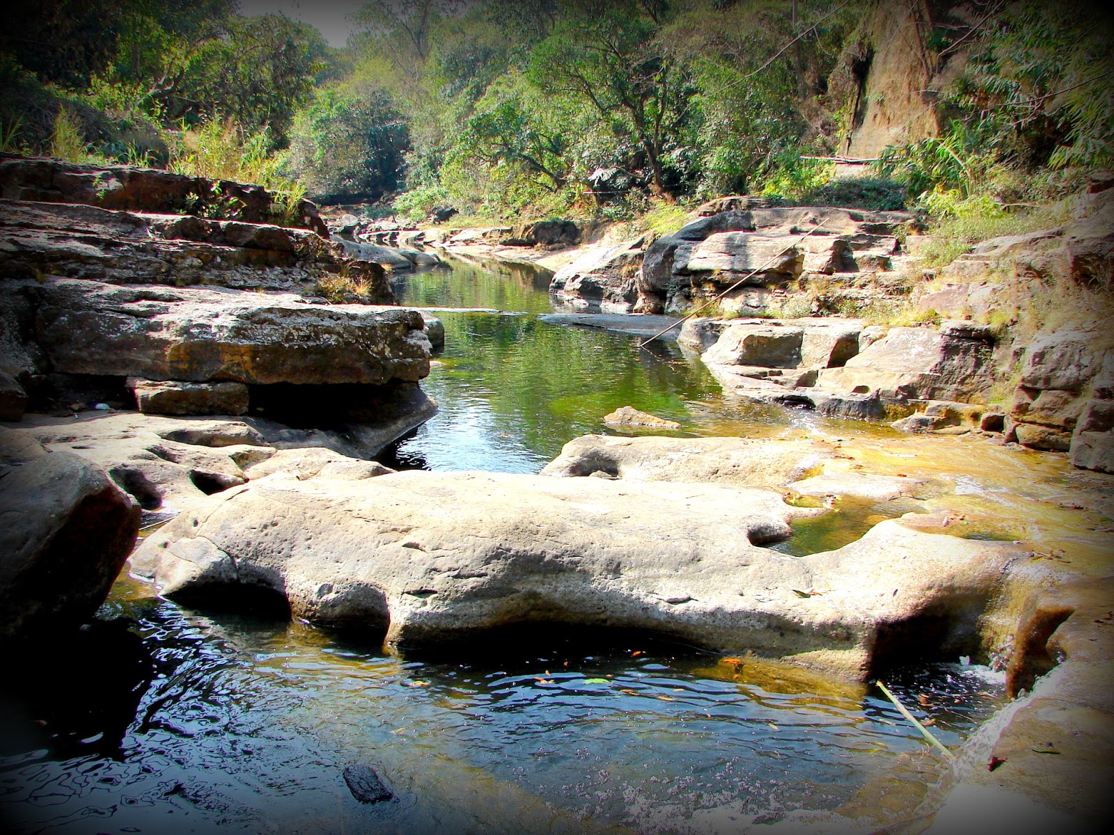

Had we brought camping equipment, this would have been the perfect place to pitch a tent for the night. I’m not sure if it’s safe after dark, but if camping is allowed, I would surely try it next time.


The multi-purpose cane basket. Here is an eco-friendly, innovative trash cone — isn’t it cute? Mawlynnong and Riwai are eco-tourism community ventures, and they use only natural, biodegradable materials for trash bins everywhere.


Off we went on the trail to the Living Root Bridge. As the name clearly implies, a living root bridge is an actual living bridge. :) It is formed from the roots of a living tree of the species Ficus elastica — the banyan fig, in this case.


To guide the tree’s roots in the right direction, betel nut trunks are used. The trunks are sliced down the middle and hollowed out to create root-guiding channels. The thin, tender roots of the ficus tree are led through these hollowed sections, preventing them from fanning out and allowing them to grow straight across. When they reach the other side of the river, they are rooted back into the soil.

Over time, layers of roots intertwine to form a strong, sturdy bridge capable of carrying a considerable amount of weight. Once the structure becomes very strong, stone slabs are placed on top to create a smoother walkway.


It is said that these bridges can last for hundreds of years, depending on the health of the mother tree. Since new roots keep growing, the bridge literally regenerates whenever older roots or trees die. Over the years, its strength increases as more layers of roots intertwine.

Of course, the villagers maintain them carefully and are prompt with repairs, since these bridges are often their only way to commute.


These bridges are often the only means of connecting the small interior villages of Meghalaya that do not have road access. The trail to the Riwai Bridge is not too steep, slimy, or narrow compared to many of the others.


Khasi men and women washing clothes along the beautiful stream. The same cane baskets are used to carry the clothes.


A precarious little stretch of rocky trail. 


A typical bamboo and cane hut. Mawlynnong has homestays and guest houses for visitors. I think one must stay overnight to experience the place better, since there are a couple of waterfalls and other nature trails that can be enjoyed at leisure rather than during a hurried and tiring day trip. Definitely a treat for those who enjoy a little rustic, non-city atmosphere.


A tall bamboo tower leads to a sky-view shelter. The structure is at least 10–12 meters tall and made entirely of bamboo, even the ties and joints. Initially, I was a bit scared, but once I began to trust the strength of the construction, I relaxed. The view from the top was spectacular. The feeling of being in a really high tree house could be nothing less than amazing.


There are even tree houses for visitors to stay in. I’m not sure how brave I’ll be to perch up that high for a night, but I shall give it a try next time.
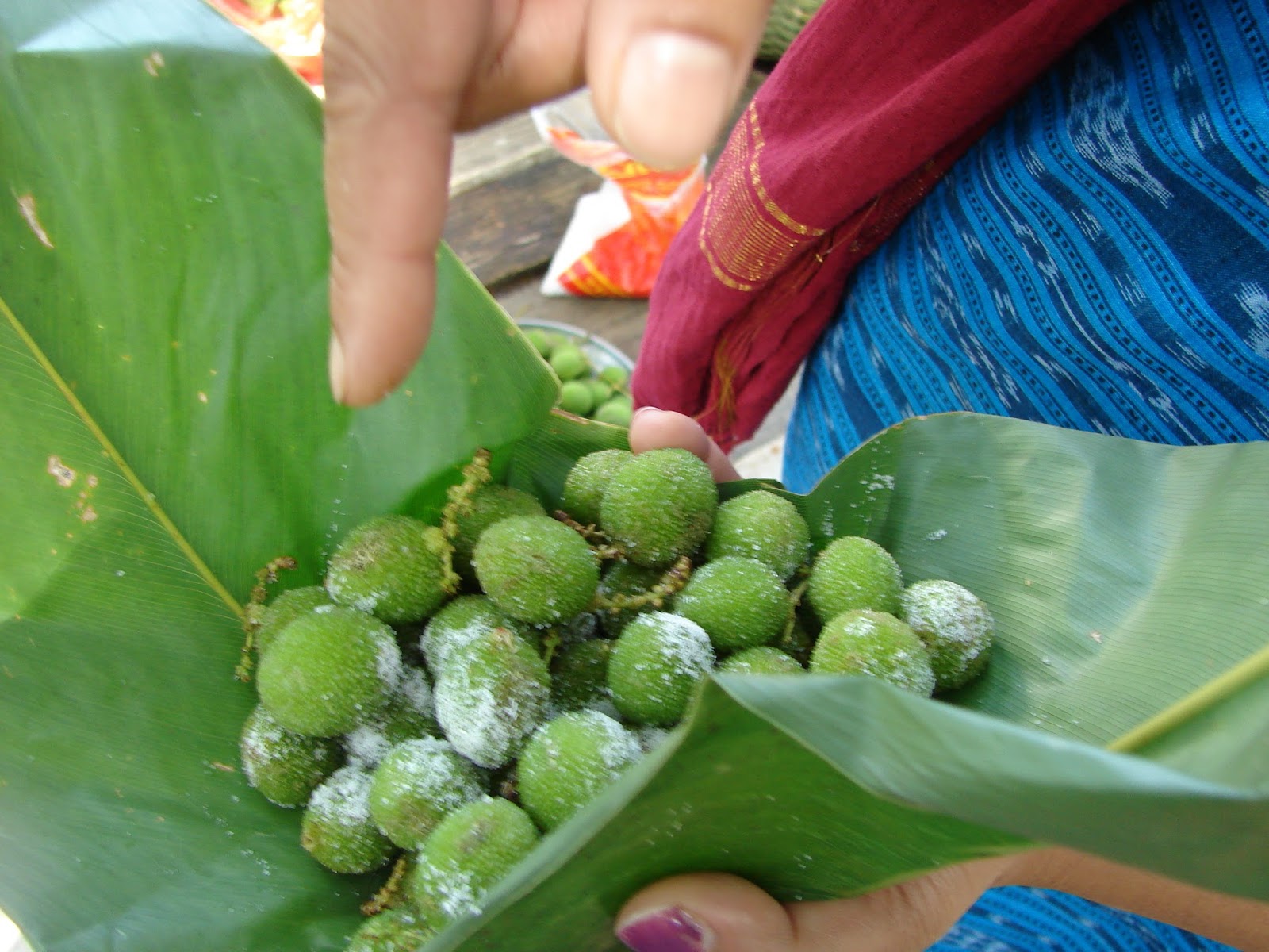

There are no restaurants in the village. The only options are homemade food and fruits offered by the villagers. We tried some new types of berries — above: Shophie, and below: Shohsang.

These berries looked quite tempting, but… but… one bite and I literally jumped. It was extremely sour! I must have mimicked one of Jim Carrey’s favorite antics as an uncontrollable tickle ran through my entire body. :P

That’s the best way I can describe the degree of sourness.


We didn’t stay back for the night, as we had plans to go to Sohra for the waterfalls. But I made a promise to myself — next time I will carry a good, fat book and stay there until I finish reading it. Fresh air and a good book should be quite relaxing. I think I should take Roots. :)

Friday, October 31, 2014

Shillong And The Khasi Hills

Shillong is the capital of the Indian State of Meghalaya and the headquarters of its East Khasi Hills district. Nongstoin is the headquarters of the West Khasi Hills district. Shyllong, a local native deity, gives this City its name. Its old name was Yeddo and Lewduh. It was a favorite destination of the British when the East India Company occupied India. They found a climate similar to Scotland and called it the Scotland of the East. In 1874 after the formation of the state of Assam, Shillong was made its Capital. In 1972 after the division of Assam, Shillong was made a part of Meghalaya, and Dispur became the state Capital.

Hills of Meghalaya

Mary Help of Christians Cathedral

My mom grew up in Shillong and has very fond memories of the city. In my childhood, we spent many a summer in this beautiful city. Honestly, Shillong has changed a lot now. It was prettier when we were kids. Now it has grown and looks like any other City. The beautiful mountains are now covered with concrete and buildings. However, outside Shillong, much of Meghalaya is still untouched, unexplored, and free from urbanization which is in one way a blessing. Urbanization often ruins the natural ecosystem.

History of the Khasis

Legend of Origin

The Khasis are an indigenous tribe who probably migrated from southeast Asia (most likely from the great plains of the Mekong River in Cambodia) through Myanmar and Bangladesh and are of Mon-Khmer origin. The Khasis are said to be one of the first tribes to migrate to India. 

The origin of the Austroasiatic people is probably the great plains of the Mekong Basin including Laos and Cambodia. Khasic, Munda, and Nicobarese are the only three surviving Southern Austroasiatic languages spoken 

Legend has it that the Khasis are a direct descendent of Hynniew Trep (meaning 'seven huts' in Khasi) who was the equivalent of Adam in the Bible (the first human created by God). Hynniew Trep and his seven sons belonged to 7 of the 16 clans of Heaven (Khadhynniew Trep - Heavenly huts). They descended to Earth from Heaven through a sacred vine, located at U Lum Sohpetbneng called Khynriam Ka Brew Ka Bneng which meant the 'Golden vine bridge of heaven', a kind of living root-ladder-like bridge connecting Heaven and Earth. The 7 clans were called Ki HynniewTrep (people of seven huts) and their land was called Ri HiniewTrep (The land of the seven huts). The seven sons were Khynriam, Pnar, Bhoi, War, Maram, Lyngngam, and Diko (extinct now) who founded the seven Khasi tribes. However, many sociologists believe, that Khasis do not have sub-tribes but are classified by their place of habitat.

Ramew, Mother Earth, and Basa her husband were created by God (U Blei Trai Kynrad) as a part of the Universe. Over time Ramew felt lonely and requested God for company. God blessed them with 5 children in the form of Moon (son), Sun, Water, Wind, and Fire (daughters). Ramew and Basa were happy, yet there was emptiness since the beautiful garden of Earth nurtured by Ramew, Basa and their Children did not have anyone who could avail and enjoy this nature's trove. Realizing, the need, God then sent 7 of his clans to Earth. The remaining 9 clans remained in Heaven. However, God gave the condition that as long as the seven clans lived a righteous life, they could visit Heaven through the bridge but the day they chose the dark paths, the living bridge would wither and die and so it did when the clans began to fight among themselves and cut down a sacred tree at Lum Diengiei. 

The places formed by legends

The location of the seven huts

The Khasis like the Jaintias are matrilineal and matrilocal. The youngest daughter inherits the property and takes the responsibility of the family. In the absence of a daughter, the mother's youngest sister inherits the property and family responsibility. The surname is passed down by the mother and the groom moves to the bride's family.

The Khasis originally were nature worshippers and their religion was called Niam Tre or Niam Khasi. Later many converted to Christianity and Islam or adopted the Hindu way of life. 

Khasi Kingdom

The Khasi kingdom comprised 25 sovereign states (Hima) under 25 powerful Chiefs (Syiem). Later, many of these states were annexed by the Jaintia Kingdom. By the 19th century, the entire Khasi kingdom came under British rule and became a part of the Assam Province. In 1830, the Khasis led by Tirot Singh, the Chief of Nongkhalaw, revolted against the British but were eventually defeated after a four-year-long uprising.

The 25 Khasi States before independence
Places of interest

Places of interest in the West Khasi Hills that can be visited from Shillong as day trips. 

Places of interest in the East Khasi Hills which can be visited from Shillong as day trips

Places of interest within Shillong
Nonghum Island in West Khasi Hills

Aerial view of Weinia Falls from Google Earth

Kshaid Lanshiang falls view on Google Earth

Kshaid Thum and the beaches of Nongkhum Island (aerial view from Google Earth)

Green Deserts - Wah Rilang (Photograph source: Official Meghalaya Facebook Website)
Weinia Falls (Photo source: Official Meghalaya Tourism Facebook Page)

Makyrduk Monolith (Photo source: Official Meghalaya Tourism Facebook Page)

Makyrduk Monolith aerial view from Google Earth

Mawdohnud (Photo source: Official Meghalaya Tourism Facebook Page)

Mawdohnud, aerial view from Google Earth

Kyllang Rock (Photo source: Official Meghalaya Tourism Facebook Page)

Aerial View of Kyllang Rock from Google Earth

War's Lake, aerial view from Google Earth

Pamphyrnai Lake, aerial view from Google Earth

Lum Symper, aerial view from Google Earth

Dingding-Kohlangat Falls, aerial view from Google Earth

Double Root Bridge near Cherrapunji. (Picture source: Official Meghalaya Tourism Facebook Page)

Kynrem waterfall (Picture source: Official Meghalaya Tourism Facebook Page)

Aerial view of Kynrem Falls from Google Earth