|
| The Pangong Tso (Tso in the local language, Bodhi, or Ladakhi means lake) |
 |
| ROUTE MAP OF LADAKH |
LOCATION
Country: India
Union Territory: Ladakh
MAIN CITIES AND TOWNS (one must be acquainted with them to plan the itinerary)
1. Delhi, the Capital of India
2. Srinagar, Capital of Jammu and Kashmir
3. Leh, Capital of Ladakh
4. Chandigarh
5. Shimla
6. Manali
HOW TO REACH
One can plan an itinerary of various combinations of flight, train, bus, personal/Hired vehicle, or treks.
By road
The route is marked on the map above.
Route 1. Basing Delhi as a starting point one can take the route via Manali, Keylong, and Sarchu to Leh.
Delhi to Manali: 574 Kms approx. takes anywhere between 9 hours, depending on the road condition.
Manali to Leh: 473 Km approx takes around 13 hrs, depending on the road conditions.
It is advisable to break the journey once at Manali and then at Sarchu.
Route 2: Basing Delhi as the starting point one can take a route via Chandigarh, Jammu, Srinagar, and Kargil to Leh
Delhi to Srinagar: 860 km and takes about 14 hrs in the best conditions.
Srinagar to Kargil: 204 Kms
Kargil to Leh: 234 Kms
It is advisable to break the journey once at Srinagar and then at Kargil.
By flight
The various airports on this route are:
1. Delhi (DEL) (International Airport)
2. Chandigarh Airport (IXC)
3. Jammu Airport (IXJ)
4. Srinagar Airport (SXR)
5. Shimla airport (SLV)
6. Kullu-Manali airport (KUU)
7. Leh Airport (IXL)
 |
| View of the Himalayas from the airplane on the way to Leh |
I traveled to Leh via flight from Delhi and took me about an hour. From the airport, I joined two Japanese co-passengers to share a room at a local homestay. I was told it was one of the oldest homestays in Leh. Honestly, it wasn't great but it cost me just a couple 100 rupees and I was shocked that one could find accommodation for this price. I moved to a hotel the next day. It was not expensive either.
 |
| View of Leh Palace from the terrace of Old Ladakh Guest House |
One word of caution: When traveling directly to Leh by flight it is advisable that one spends the first day at rest, getting acclimatized to the altitude and pressure change. Leh is at an altitude of 3500 m (11500 ft) above sea level and hence lower oxygen level which causes breathlessness and altitude sickness that lasts for a few hours. There are healthcare workers who provide the required assistance in case of severe health issues. People with heart conditions and pressure problems should take the required precautionary measures.
My Japanese roommates went out right after keeping their bags at the homestay for a city tour and came back pretty sick with breathing problems. They had to return back to Delhi the very next day. Hence, it is absolutely necessary to relax at the hotel on the first day and go out for site seeing only when you feel at ease.
By train
One can travel a part of the journey by train.
1. Delhi to Kalka and then the toy train to Shimla or take a bus or car to Shimla.
2. Delhi to Jammu
WEATHER and WHAT TO WEAR
Ladakh experiences extreme temperature variation. Peak summer could reach up to 35 C and peak winters can go as low as -30 C. I visited Ladakh in mid-July and stayed there till early October. The temperature was warm to pleasant. Some friends who visited in June mentioned that the weather was freezing cold at higher altitudes. Summer lasts between April and September end. Peak winter sets in around mid-November and stays till early February. The ice on the passes begins to thaw around March end.
The terrain is dry and dusty due to barren mountains and scanty rainfall. The sun can be extremely strong here. Cotton clothes with long sleeves, and a loose fit, are the most comfortable wear in this region. It is advisable to carry a warm jacket at all times cause the weather is unpredictable and it can get pretty cold even in peak summer.
Sunscreens, sun shades, and closed shoes are absolute carry-alongs. If visiting monasteries it is preferred that one wears clothes that cover the arms and legs. No one openly objects but it is not considered respectable to expose. This dress code applies to both men and women.
WHERE TO STAY and WHAT TO EAT
There are luxury hotels to inexpensive guest houses in Leh. One can even find another traveler to share a room with. I think the minimum I spent was Rs. 300 for a room in one of the oldest guest houses in Leh and the maximum I spent was Rs. 600 at a small hotel near the city center market. Not the best rooms but good enough (according to me) for a night's stay!
There are good restaurants and bakeries in the city center market. Leh is very small and any part of the city can be reached easily by walk. The main market was a 9-minute walk from the Old Ladakh Guest House. Later in the trip, I moved to a hotel in the market area.
 |
| Maggi was my staple diet in Ladakh for most days. Day 1 Dinner Maggi, Pineapple juice, munch, and orange wafer. It was 14th August and 'Indian Summer' was the perfect book to start that night.."When midnight struck in Delhi on the night of 14 August 1947, a new, free Indian nation was born. In London, the time was 8:30 p.m. The world's capital would enjoy another hour or two of a warm summer evening before the sun literally and finally set on the British Empire" |
ACTIVITIES
As mentioned above, Leh is quite small and one can easily access the main points of interest on foot. There are no public transportation facilities. At least there were none when I visited in 2012.
There are travel agents who can arrange vehicles for your sightseeing tours. One can also rent Motorcycles and cycles to travel around.
Main activities in the region, meditation at meditation centers, visiting monasteries, trekking, sightseeing trips to the lakes, and river rafting.
PLACES TO VISIT
Lakes
1. Pangong Tso - It takes almost a day to visit Pangong Tso from Leh and back but there are options to stay at Dhaba camp on the bank of Pangong and home stays at Spangmik Village but the availability is not guaranteed and the facilities are very basic.
I went on a day trip to Pangong Tso with a group of local tourists on a jeep arranged by a local travel agent. We did not stay back, since we had plans to head for Nubra Valley the next day.
 |
| About to reach Pangong Tso |
2. Tso Moriri - Traveling to Tsomoriri also takes an entire day if one wishes to come back to Leh but there are homestay options at Korzok village near the lake. Visit to Tso Moriri was also a day trip on a jeep.

 |
| Tso (Lake) Moriri |
Valleys in Ladakh
1.
SURU and ZANSKAR VALLEY
2.
SHYOK and NUBRA VALLEY
3. DRAS and MUSHKOH VALLEY
4.
INDUS VALLEY :
The Indus Valley gets its name from the River Indus that flows through this region. The main attractions here are:
 |
| INDUS VALLEY ROUTE MAP |
 |
| Confluence of Zanskar and Indus. In winter this gets frozen and adventure seekers and local travelers walk on the frozen river to Zanskar Valley down south. The trek is called Chaadar (sheet - sheet of ice) Trek |
Day 1
Leh
The first day was spent resting, reading, and sightseeing from the terrace at the guest house. Leh is the administrative capital of Ladakh and the biggest city in the region. Most people base their trips at Leh. Major attractions in Leh include the Leh Palace and Shanti Stupa.
 |
| On the way to Leh Palace |
Day 2
Leh Palace was hardly a 5-minute walk from the guest house we were staying at. We went there on the second day. One can see the mud houses of Leh from the top floors of the Palace. From Leh Palace, I went to the local market and shopped for some handicrafts and also visited the museum. The Shanti Stupa was not very close, so I took a ride to it. From there, we headed back to the guest house. We were still getting acclimatized and hence were getting out of breath after walking a short distance.
 |
View of Leh from Leh Palace
|
 |
| Shanti Stupa |
Day 3
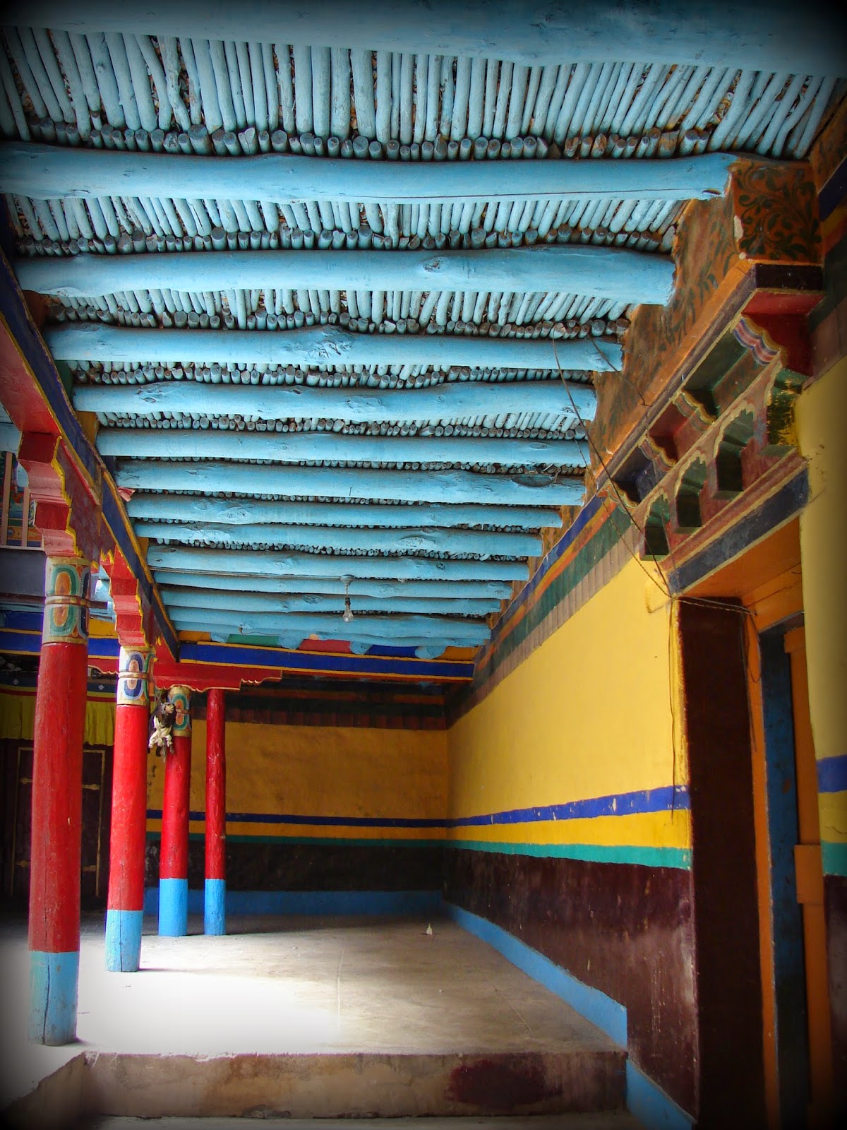
On the third day, we felt a lot better and decided to head for the monasteries. We booked a vehicle through a local travel agent we met in the market the previous day. He came along to guide us through the trip. He did tell us that there would be a lot of walking and we should proceed only if we felt fit and fine. We were so fascinated by the monasteries and their architecture, that altitude sickness took a leave of us. We walked to every nook and corner of the monasteries which surprised the guide. He said most visitors just click a few photographs and head back, we were one of the few who went to every single room, floor, and corner of all the monasteries, and palaces we visited.
To the southeast of Leh are Shey, Stok, Thikse, Stakna, and Hemis monasteries. It might take a few hours to a whole day to cover this stretch depending on how enthusiastic one is to explore every nook and corner of the monasteries.
 |
| We started early at 5:00 a.m. and reached Thiksey Monastery around 5:30 a.m. where the monks start the morning prayers by blowing long Tibetan horns/trumpets called Rag-dung |
 |
| The travel distance from Leh City center is just 1 hr 35 mins but we spent the entire day exploring the palaces and monasteries and returned pretty late in the evening after participating in the evening prayers at the Hemis |
 |
| The Shey Palace |
 |
| The Thiksey Monastery |
 |
| The Stakna Monastery |
 |
| The Hemis Monastery |
|
 |
| The Stok Monastery |
Day 4
On the fourth day, we visited the monasteries on the northwest side of Leh, which include, Spituk, Alchi, Lamayuru, Likir, and Basgo monasteries among many others. My special mention would be Alchi. Beautiful wood carvings and amazing wall paintings adorn this gompa. On the way to the North West stretch, one may also visit the Nanak sahib Gurudwara which is considered a very sacred pilgrimage shrine for the Sikhs. The drive itself is scenic and it often feels like a painted landscape.
 |
| We started the day earlier on the fourth day and returned a lot later as well. Must Mention Lamayuru and Alchi took my breath away:) |
 |
| 5:00 a.m. morning prayer at Spituk Monastery |
 |
| Flower offerings at Spituk Monastery |
 |
| The Spituk Monastery |
 |
The Basgo Monastery
|
 |
The Lamayuru Monastery
|
 |
| On the way to Lamuyuru, there is a stretch of rough badlands called Moonland |
 |
| There is a stretch of land on NH1 called the Magnetic Hill where vehicles get pulled against gravitation. I was not convinced but I guess it happens cause everyone there said so :) |
 |
| India's northernmost highway NH 1 |
 |
The Likir Monastery
|
 |
| Gurudwara Patthar Sahib at 12000 ft above sea level is one of the highest Gurudwaras in the world |






.jpg)