 |
| The Market Place of Yesteryear |
The word haunted sends shivers yet excites. I like to believe there are no spirits, yet I am every bit scared. Right now! at this wee hour of the morning, typing about Bhangarh and reading the various related stories on the internet is giving me goosebumps. I am told the subnatural/supernatural is most active at 3 a.m. Guess what? It is 3 a.m. on my clock! And that's spooking me :)
So, Bhangarh's USP is itsdisrepute reputation of being haunted. Unfortunately or perhaps fortunately, we didn't see any bhoot pret petni pishach shakchunni or any other type of ghosts!! :( But the place definitely holds an air of intrigue.
So, Bhangarh's USP is its
 |
| Can this be interpreted as a poltergeist effect :P |
Perhaps, even the spirits are facing the loss of habitat and are on the verge of extinction?? :( Thanks to all ghost hunters flocking to these ruins!! (yups that includes me and am contradicting the very purpose of this blog :P). Never mind the weird theory, ghosts are ghosts and they will drive us, humans, off if they need to protect their home, and isn't that what we seek, the thrill of fear!! If you are the daredevil adrenaline junkie, this is THE PLACE for you, BUT only after sunset and before sunrise, you might just get lucky enough to romance the ghosts.
I asked a night guard if he ever chanced to witness any paranormal activities during his night rounds. His answer was "Sab Hawa mein hai. Kabhi Kisi ka samaye kharab hota hai toh shayad kuch dikh jaaye." (It's all in the air. If someone is in for a bad time, he might get to see something." Well, many have claimed to have felt the paranormal presence at the fort. The internet is full of such stories. A program on the Discovery Channel even went on record to say, it is the most haunted place in India. Rocky and Mayur's show on haunted places described Bhangarh as an eerie place. Giving a gruesome example of their experiences in Bhangarh, Mayur says, "While we were shooting at night in Bhangarh, many times we heard very high pitch screams from the mountains. Once we saw a blurred figure of a woman walking around. Though it was only for a few seconds we could easily make out that something is there and we can not deny their existence," adds Mayur. Excerpt from an article in the Times of India. That reminds me of my High School St. Thomas. I think St. Thomas is one of the most haunted places on Earth. (Personal experience - shall bring the stories later).
I asked a night guard if he ever chanced to witness any paranormal activities during his night rounds. His answer was "Sab Hawa mein hai. Kabhi Kisi ka samaye kharab hota hai toh shayad kuch dikh jaaye." (It's all in the air. If someone is in for a bad time, he might get to see something." Well, many have claimed to have felt the paranormal presence at the fort. The internet is full of such stories. A program on the Discovery Channel even went on record to say, it is the most haunted place in India. Rocky and Mayur's show on haunted places described Bhangarh as an eerie place. Giving a gruesome example of their experiences in Bhangarh, Mayur says, "While we were shooting at night in Bhangarh, many times we heard very high pitch screams from the mountains. Once we saw a blurred figure of a woman walking around. Though it was only for a few seconds we could easily make out that something is there and we can not deny their existence," adds Mayur. Excerpt from an article in the Times of India. That reminds me of my High School St. Thomas. I think St. Thomas is one of the most haunted places on Earth. (Personal experience - shall bring the stories later).
The Archeological survey has a board at the entrance forbidding anyone from entering the premises before sunrise and after sunset. A clarification from the department was, that they prefer people away after sunset because this fort is very close to the Sariska Animal Reserve and wild animals often wander off from the forest to the fort. Not to forget a million snakes. Rajasthan is home to 30 varieties of snakes including the great python and the 4 venomous Cobra, Krait, Russel Viper, and Pud. The Aravali terrain also gives shelter to the deadly scorpions. I guess these are as scary if not more than the ghosts
Well ghosts or no ghosts, this place is worth a visit. The journey is every bit haunting, from Sariska to Bhangarh........from the past to present. Every ruin echoes a time gone by. Some voices are left behind to tell their stories and when we hear those whispers, a chill runs down the spine.
Country: India
State: Rajasthan
Closest City: Jaipur
HOW TO REACH
Bhangarh is located approximately 95 km from Jaipur and approximately 300 km from New Delhi. If you are a hardcore bag packer, take the bus. Buses are available from Delhi and Jaipur.
Or take a personal vehicle. It is possible to make it a day trip but if you have a couple more days to spare, you might make the trip more interesting with Sariska Tiger Reserve, Alwar, Abhaneri, and Ajabgarh included in the itinerary. (Click for Abhaneri post)

From Jaipur, there is a short direct route to Bhangarh through Gopalgarh (I have no idea about the road condition), the second option is NH11 via Dausa. The road to Dausa is a 4-lane highway. Dausa to Bhangarh is through small villages.
From Delhi, the route follows Gurgaon - Bhiwadi - Alwar - Sariska (going around the reserve) - Thanagazhi - Pratapgarh - Ajabgarh, and finally Bhangarh.
There are hardly any petrol pumps, restaurants or lodging options once you cross Sariska. Keep your petrol stock, food stock, and even a spare tire. Carrying a torch would be handy if you are the inquisitive explorer in search of the real ghost:)
It's mostly warm. Preferably wear closed shoes, as mentioned scorpions and snakes have their abode in the ruins.
BEST TIME TO VISIT
Anytime is a good time to visit. We visited in mid-March and the weather was pleasant.
WHERE TO STAY and WHAT TO EAT
Sariska Reserve has a hotel that should be booked in advance. There are heritage hotels and budget hotels in Alwar. That's the closest lodging available. Preferably carry your own food. No food options at the fort except for an ice cream cart.
The Journey in Photos...
 |
| Pratapgarh |
It was quite a long 8-hour journey through small hamlets, villages, and deserted forts. Every fort gave the impression of the richness and grandeur of the 'once' Rajputana States. Each is as haunted as Bhangarh. History in ways does give goosebumps.
 | |||
| A Shaky Pic of Ajabgarh (I use an outdated antique digital camera :P) |
 |
| And more forts |
 |
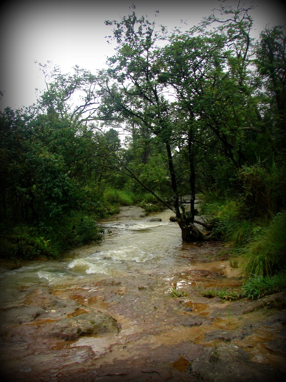
| The route is beautiful, flanked by red flowering trees. A small stream runs parallel to the road and other yellow trees adorn the landscape. I didn't get an opportunity to stop our vehicle to click the pics due to time constraints. All the more reason why one must visit these places with more time to spare |
 |
| The entrance gate to the market and temple complex leads to the fortified palace gate |
This fort was built by Raja Bhagwant Das, King of Amer and father of Mughal Emperor Akbar's General Man Singh for his second son Madho Singh in the mid 16/17th century. Legend says this small state was wiped out in one night. There are two popular stories to support this theory.
 |
| One of the many temples in the complex |
Story 1
Madho Singh was a disciple of Guru Balu Nath. Guru Balu Nath permitted Madho Singh to build his fort with the condition that Bhangarh could grow only to a point where its shadow would not touch his ashram. It was the Guru's way of teaching his pupils to not cross the limits of power and riches.
 |
| The Shiv Temple |
As years have gone by, the King and his descendants forgot the condition. The Bhangarh fort expanded and one day it reached a height from where its shadow touched Guru Balu Nath in meditation. The angry hermit laid a curse on the kingdom, and overnight it perished, never to be revived again. It is said every single living being died and perhaps those untimely deaths left the place haunted.
 |
| The temple on the Top: Some say it's the Bhairon Baba temple. Some say that was the watch tower while some say it was the place of worship of the tantric Shinghia |
Story 2
Ratnavati was the beautiful daughter of Madho Singh's descendant. Smitten by her charm A Tantric named Singhia tries to win her by offering her a special oil on which he casts some love spells (kind of the love potion in Mid-Summer Night's Dream). Having known the tantric's intentions, the princess throws the oil container. The container breaks! breaking (literally) the tantric's heart. The dying tantric curses the princess that her kingdom would perish in a night. Soon after, Ajabgarh attacks Bhangarh. Bhangarh is destroyed and Princess Ratnavati dies. Locals believe Ratnavati will be born again and shall come back to revive the glories of Bhangarh. Well so far Ratnavati has not reincarnated and the Tantric's soul haunts the fort. Reminds me of a certain Telugu movie.
 |
| The 7 storied Palace within an inner fort |
 |
| The Aravalli Range |
 |
| The Peepal trees: In India, it's an age-old belief (of those who believe in the existence of spirits) that ghosts reside on Peepal trees (Ficus religiosa) It is said that this tree is the staircase to heaven. Those who have sinned are not allowed to exit to the other world and they hang from the Peepal tree's branches as ghosts. :P Honestly, with roots like that, they are bound to scare people. And to think there's a ghost in my backyard :P sends me shivers. |

 | |
| The Chattri (Memorial tomb which does not have the grave of the deceased) |
Like all princely states, Bhangarh went through its ups and downs. Mughal Siege, slow decline, and then famine. Bhangarh breathed its last in the 18th century after the famine.
 | ||||
| The ruins of the village within the outer fort |
 |
| The part of the village that's still inhabited |

 |
| The last gate / The first gate...The end to begin again. |