Showing posts with label waterfall. Show all posts

Friday, September 15, 2023

The Untouched Jaintia Hills

From Tyrshi Falls, Jowai

The Jaintia Hills lie on the eastern side of Meghalaya. Jowai is the official headquarters of West Jaintia Hills and Khliehriat is the official headquarters of East Jaintia Hills. Jaintia Hills were a part of the Jaintia Kingdom. The Greater Jaintia Kindom spread across parts of the present-day, states of Meghalaya, and Assam in India and the present-day state of Sylhet in Bangladesh. Its winter capital was Jaintapura, in present-day Bangladesh, and its Summer capital was in Nartiang, present-day India. Later in 630 AD Jaintia king Raja Guhak (as per Wikipedia) divided the kingdom among his three sons - Jaintia Kingdom (present-day Meghalaya and Assam) went to Jayantak, Gour Kingdom (Northern Sylhet in Bangladesh) went to Gurak and Laur Kindom (another part of present-day Sylhet) went to Ladduk. 

What was the history of the Jaintia tribes is a bit of a contradiction. Some say they were an Austroasiatic tribe of Mon-Khmer Origins, who traveled to India from East Asia or South East Asia. Some say they were the origins of present-day Cachar or present-day Sylhet. I lean towards the former version considering the features and cultures of the Jaintias. 


As per some historians, a group of Mon-Khmer tribes traveled to the Kopilli Valley, from Tonquin (a region in North Vietnam) Via Yunan (a southwestern province of China), and Myanmar. They settled in the Kopilli Valley fed by the Kopili River. Later after the Indo-Aryan rulers took over this region under their reign and established the Pragjyotish Kingdom, the tribe moved west and north. Eventually, they settled in the region known as the Jaintia Hills.

The migration of Mon-Khmers from Tonquin to Kopilli Valley


The Kopili River Valley

The Jaintia kingdom went through many changes and rulers till the Britishers annexed it in 1835. One of the first known rulers of Jaintias was queen Urmi Rani. Jaintias are Matrilineal like the Khasis and Garos of Meghalaya. As the term suggests, the women carry forward the lineage, the surnames, and the inheritance. The youngest daughter of the family inherits the property. If the youngest daughter dies or is disowned, the immediate elder daughter inherits the property, and then her youngest daughter carries forward the inheritance. If there are no daughters in the family, the mother's youngest sister inherits the property and it continues in the same order. After marriage, the men move into the bride's family. Ancient Jaintia Kindom was ruled by Queen Monarchs. Women were powerful and highly respected.

Medieval Kingdoms of North Eastern India

The Jaintia matrilineal traditions continue even to the present day. Some Jaintias today are converted Christians and Muslims and some follow the Hindu way of living but the indigenous Jaintias worshipped nature their religion is called Niamtre and they follow three cardinal principals, Kamai yeh hok, tipbru tipblai, and tipkur tipkha which signify, honest living and livelihood, fulfilling duties for fellow humans, and all living beings, respect for the family.

Ruins of Jaintia KIngdom in Jaintapur in Bangladesh (Source: Wikipedia)

Jaintia Hills is a region still not destroyed by human activities. It is endowed with lush green vegetation, beautiful waterfalls, and crystal clear-water rivers. Some famous points of interest are Tyrshi Waterfall, Nartiang monoliths, Umngot River, and Thlu Amwi Waterfall among others.

Places of interest in Jaintia Hills

Tyrshi waterfall (picture source Wikipedia)

Nartiang Monoliths (Picture source wikipedia). These monoliths were erected by Jaintia rulers in honor of their predecessors. This collection of monoliths is perhaps the largest collection in any one place

Thlumuwi Waterfall (Picture source Wikipedia) This falls is famous for a stone footbridge built by the Jaintia rulers 

Umngot River (Picture source Wikipedia). The Umngot or Dawki River is famous for being one of the cleanest rivers in India

Friday, May 26, 2023

Historic Columbia River Highway And Multnomah Falls

I traveled to Portland during the Thanksgiving weekend. The flight from Fargo took me about 6 hours. Multnomah Falls is about 32 minutes from Portland. It's the tallest in Oregon and the drop is about 620 ft (upper fall is 542 ft,  lower fall is 69 ft and there is a gradual slope between the two of about 9 ft). The fall gets its name from the Multnomah tribe who lived around this area. The fall is fed by the springs of Larch Mountain, an extinct volcano. Legend has it, that a Multnomah woman sacrificed herself by jumping off the cliff of the mountain to save the tribal village from the plague. After the village was saved, it is said that water started to trickle down the cliff eventually forming the waterfall.


The Portland to Multnomah takes route 1-84, a part of which is the first planned scenic route in the US. It is called the Historic Columbia River Highway. The historic route spans between Troutdale and The Dalles


Google Earth aerial views of the waterfall


Upper and Lower Falls


Lower Falls


Multnomah Creek in the Columbia River Gorge

Wednesday, April 19, 2023

Chitrakote Falls - Asia's Widest Waterfall


I went to Chitrakote Falls a very long time ago in the late 1990's probably around 1996. It was a forest area and there was no road to the falls. We parked our car on the nearest road available which was about an hour's walk from the falls. Our driver who was a native of Bastar, requested some Adivasis who lived in the forests around to lead us to the falls. Initially, the tribesmen didn't like the idea cause they felt we were intruding into their homeland but after some requests, they agreed and one of them led us to falls through the forest. There was no road, it was a forest path. It took us about 30-40 minutes or more to reach the waterfalls. The area around the falls was rocky with scarce vegetation. Since it was not the monsoons, the falls were not in their maximum flow but still grand as could be. It was even more exotic at that time cause it was unexplored and the stories the Adivasi told us through the forest trek were enlightening. He showed us his hunting weapons and showed us many trees and plants that had medicinal properties. Unfortunately, I lost most of my photographs taken before 2005. 

The waterfall area was developed into a tourist spot post-2003. I feel it was a lot better when it was hidden and unexplored. I guess the Adivasi were displaced too when the area was developed. Sometimes, I feel the Adivasis were right when they refused us at first. we did intrude into their homeland and uprooted them from their roots.


Considered Asia's widest waterfall

The falls is located on the Indravati River. River Indravati is a tributary of Godavari


Friday, October 31, 2014

Cherrapunji / Sohra, The Wettest Place On Earth

On the way to Cherrapunji

As a kid, I had this strange obsession wanting to visit Cherrapunji having read about it in school as the wettest place on earth (the position has now been gracefully taken over by Mawsyngram). My grandfather was posted in Shillong, hence we often visited the then Scotland of East almost every summer (Shillong is not the same anymore), and each time I voiced my last wish as if it were so, to visit the land of oranges, as it meant in the native language. Reaching Cherrapunji then was no less than an adventure with bad roads and limited means of access much unlike today, Hence, that wish kept getting postponed year after year until my grandfather moved out of Shillong, and the Cherranpunji visit got stalled for years. Finally, in 2014 D day arrived, and I got the opportunity to visit Sohra, the old name of Cherrapunji that has been reinstated by the Meghalaya government.

Places of interest close to Cherrapunji


It was wet literally

It was more like God wanted me to experience what the kid me had wished for many many years back - the wettest place on this planet, though that wasn't exactly what I had in mind after growing up :P.  It drizzled the entire day with lucky sun breaks once in a rare while.

Cloud-covered lush green valleys

The fog had shrouded the entire valley. Even driving was getting risky at times, the road was only faintly visible most of the journey. At times when the fog lifted and the drizzle stopped, I would hungrily savor the lusciousness of the panorama in front of my eyes. Wow!! could anyone even imagine there was so much green behind all that white ?!?


Enchanting! Dreamy !! Surreal !!! I could sit there for hours just to stand and stare and then disappear into the next misty spell.


Nohkalikai waterfall

Luckily enough, I saw the Nohkalikai waterfall, the tallest waterfall in India. It wasn't in its best flow but still spectacular. The name Nohkalikai is associated with a tragic story.


Ka Likai who lived in Rangjyrteh, a village close to the waterfall, had a suspicious second husband. The man disliked her child from her first marriage. One day, when Ka Likai went to the forest to collect wood, her husband killed the child and cooked a delicious meal of her meat. He served it to K Likai when she returned hungry and tired. Without much thought she ate the food and turned to her husband, asking him what had he cooked? It was so delicious. The evil man smirked and said it was her child. The shock of the heinous deed and her own guilt of eating her own child turned Likai insane. Maddened she ran out of her house screaming for forgiveness and waving an ax at anyone who tried to stop her. She ran till the edge where the falls plunged off the precipice and threw herself along with the raging water. Ever since then, the fall has been called Noh Ka Likai ( from where Ka Likai jumped - Noh means jump in Khasi).


Site of the seven sisters waterfalls

The scene at the Seven Sisters, Nohsngithiang Falls was veiled in white. We could only hear the gushing water. The locals said to wait till the wind blew the mist away. We waited for hours but the curtain refused to rise to our greatest disappointment :(


A photograph of the Nohkalikai at a restaurant near the falls shows its full flow right after monsoons around July. Calls for a return.


The same followed at the Mawsmai caves. We were told the water in the caves was pretty high, though many people still ventured in, so we decided to pass it. On the way, the fog had cleared a bit and we spent some time along this pretty streamlet. 


Not before long, the fog curtained the magical greens, blues, browns, and all the many colors with stark white, as if to say, "That's it for now! come back again for the whole movie, this was only a curtain raiser" Of course, I definitely shall! for so much was missed! :) At times I think, I can rechristen Sohra as Kohra (mist in Hindi) :P


Shillong And The Khasi Hills

Shillong is the capital of the Indian State of Meghalaya and the headquarters of its East Khasi Hills district. Nongstoin is the headquarters of the West Khasi Hills district. Shyllong, a local native deity, gives this City its name. Its old name was Yeddo and Lewduh. It was a favorite destination of the British when the East India Company occupied India. They found a climate similar to Scotland and called it the Scotland of the East. In 1874 after the formation of the state of Assam, Shillong was made its Capital. In 1972 after the division of Assam, Shillong was made a part of Meghalaya, and Dispur became the state Capital.
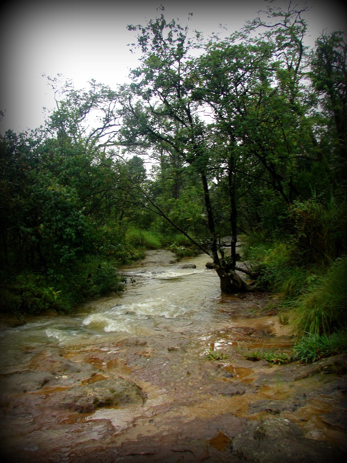
Hills of Meghalaya

Mary Help of Christians Cathedral

My mom grew up in Shillong and has very fond memories of the city. In my childhood, we spent many a summer in this beautiful city. Honestly, Shillong has changed a lot now. It was prettier when we were kids. Now it has grown and looks like any other City. The beautiful mountains are now covered with concrete and buildings. However, outside Shillong, much of Meghalaya is still untouched, unexplored, and free from urbanization which is in one way a blessing. Urbanization often ruins the natural ecosystem.

History of the Khasis

Legend of Origin

The Khasis are an indigenous tribe who probably migrated from southeast Asia (most likely from the great plains of the Mekong River in Cambodia) through Myanmar and Bangladesh and are of Mon-Khmer origin. The Khasis are said to be one of the first tribes to migrate to India. 

The origin of the Austroasiatic people is probably the great plains of the Mekong Basin including Laos and Cambodia. Khasic, Munda, and Nicobarese are the only three surviving Southern Austroasiatic languages spoken 

Legend has it that the Khasis are a direct descendent of Hynniew Trep (meaning 'seven huts' in Khasi) who was the equivalent of Adam in the Bible (the first human created by God). Hynniew Trep and his seven sons belonged to 7 of the 16 clans of Heaven (Khadhynniew Trep - Heavenly huts). They descended to Earth from Heaven through a sacred vine, located at U Lum Sohpetbneng called Khynriam Ka Brew Ka Bneng which meant the 'Golden vine bridge of heaven', a kind of living root-ladder-like bridge connecting Heaven and Earth. The 7 clans were called Ki HynniewTrep (people of seven huts) and their land was called Ri HiniewTrep (The land of the seven huts). The seven sons were Khynriam, Pnar, Bhoi, War, Maram, Lyngngam, and Diko (extinct now) who founded the seven Khasi tribes. However, many sociologists believe, that Khasis do not have sub-tribes but are classified by their place of habitat.

Ramew, Mother Earth, and Basa her husband were created by God (U Blei Trai Kynrad) as a part of the Universe. Over time Ramew felt lonely and requested God for company. God blessed them with 5 children in the form of Moon (son), Sun, Water, Wind, and Fire (daughters). Ramew and Basa were happy, yet there was emptiness since the beautiful garden of Earth nurtured by Ramew, Basa and their Children did not have anyone who could avail and enjoy this nature's trove. Realizing, the need, God then sent 7 of his clans to Earth. The remaining 9 clans remained in Heaven. However, God gave the condition that as long as the seven clans lived a righteous life, they could visit Heaven through the bridge but the day they chose the dark paths, the living bridge would wither and die and so it did when the clans began to fight among themselves and cut down a sacred tree at Lum Diengiei. 

The places formed by legends

The location of the seven huts

The Khasis like the Jaintias are matrilineal and matrilocal. The youngest daughter inherits the property and takes the responsibility of the family. In the absence of a daughter, the mother's youngest sister inherits the property and family responsibility. The surname is passed down by the mother and the groom moves to the bride's family.

The Khasis originally were nature worshippers and their religion was called Niam Tre or Niam Khasi. Later many converted to Christianity and Islam or adopted the Hindu way of life. 

Khasi Kingdom

The Khasi kingdom comprised 25 sovereign states (Hima) under 25 powerful Chiefs (Syiem). Later, many of these states were annexed by the Jaintia Kingdom. By the 19th century, the entire Khasi kingdom came under British rule and became a part of the Assam Province. In 1830, the Khasis led by Tirot Singh, the Chief of Nongkhalaw, revolted against the British but were eventually defeated after a four-year-long uprising.

The 25 Khasi States before independence
Places of interest

Places of interest in the West Khasi Hills that can be visited from Shillong as day trips. 

Places of interest in the East Khasi Hills which can be visited from Shillong as day trips

Places of interest within Shillong
Nonghum Island in West Khasi Hills

Aerial view of Weinia Falls from Google Earth

Kshaid Lanshiang falls view on Google Earth

Kshaid Thum and the beaches of Nongkhum Island (aerial view from Google Earth)

Green Deserts - Wah Rilang (Photograph source: Official Meghalaya Facebook Website)
Weinia Falls (Photo source: Official Meghalaya Tourism Facebook Page)

Makyrduk Monolith (Photo source: Official Meghalaya Tourism Facebook Page)

Makyrduk Monolith aerial view from Google Earth

Mawdohnud (Photo source: Official Meghalaya Tourism Facebook Page)

Mawdohnud, aerial view from Google Earth

Kyllang Rock (Photo source: Official Meghalaya Tourism Facebook Page)

Aerial View of Kyllang Rock from Google Earth

War's Lake, aerial view from Google Earth

Pamphyrnai Lake, aerial view from Google Earth

Lum Symper, aerial view from Google Earth

Dingding-Kohlangat Falls, aerial view from Google Earth

Double Root Bridge near Cherrapunji. (Picture source: Official Meghalaya Tourism Facebook Page)

Kynrem waterfall (Picture source: Official Meghalaya Tourism Facebook Page)

Aerial view of Kynrem Falls from Google Earth